Summary
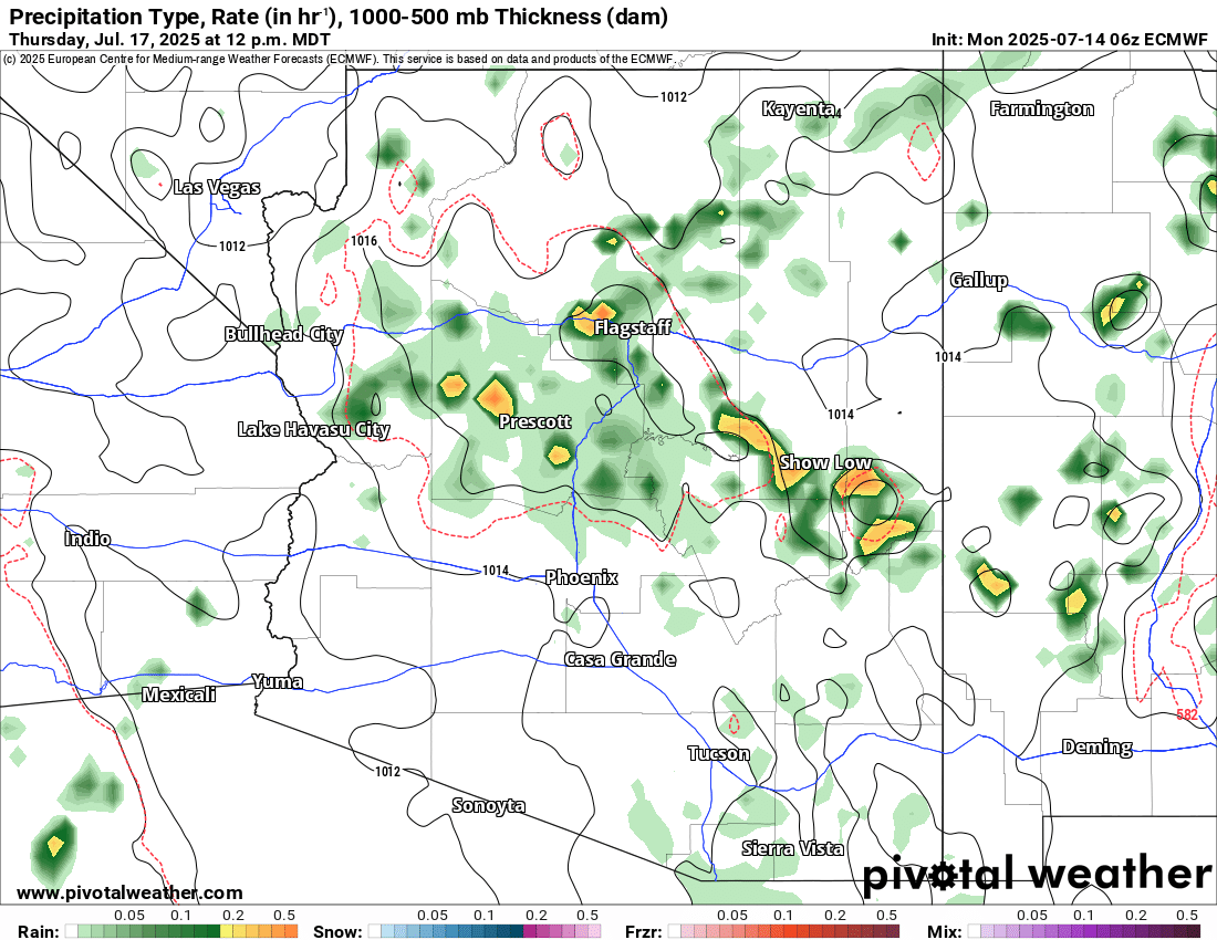
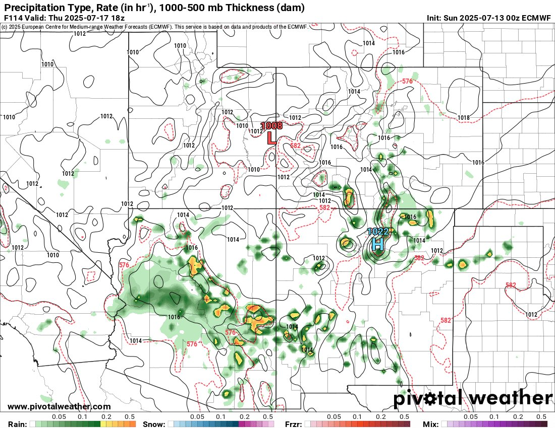
Current ensemble and deterministic guidance indicates that Lake Havasu City sits on the western fringe of an approaching monsoon moisture surge valid Thursday 17 July. A weighted blend of ECMWF and GFS output supports a ~34 % probability of measurable rainfall (> 0.01 in) during the noon-to-sunset period. While convective coverage will be scattered, any cell that survives the dry low-levels could deliver a brief downpour and gusty, dust-laden outflow winds.
1. Synoptic & Mesoscale Setup
| Parameter | ECMWF (06 z, Fig. 1) | GFS (12 z sounding, Fig. 2) | Implication |
|---|---|---|---|
| Column precipitable water (PW) | 0.9 – 1.1 in over lower Colorado Valley; ≥ 1.25 in east of Prescott | Same magnitude, slightly drier west | Marginal but sufficient moisture for high-based convection |
| Mid-level steering flow (500 mb) | 5 – 10 kt S–SE | 5 kt S | Weak flow allows storms to drift NW toward the river |
| Surface temperature forecast | 106 – 108 °F | 104 – 106 °F | Strong heating helps erode convective inhibition by early afternoon |
| Mixed-layer CAPE | 500 – 800 J kg-¹ | 400 – 700 J kg-¹ | Modest instability supports pulse-type storms |
| 0–6 km bulk shear | ≤ 15 kt | ≤ 15 kt | Limited storm organization; short-lived cells |
2. Expected Timing
| Local Time (MST) | Likely Evolution |
|---|---|
| 10 am – Noon | Rapid surface heating; cumulus towers form over surrounding high terrain. |
| Noon – 3 pm | Isolated storms develop east of the Hualapai & Black Mountains; outflow boundaries may sweep west, producing 25 – 40 mph gusts and areas of blowing dust. |
| 3 pm – 7 pm | Highest chance of a convective cell crossing Lake Havasu City. Rainfall in any one spot most likely 0.05 – 0.25 in, but many locations remain dry. |
| After 7 pm | Rapid stabilisation; lingering virga and weakening gust fronts. |
3. Potential Impacts
- Rainfall: Scattered, brief downpours; basin-wide QPF consensus ~0.10 in or less.
- Wind/Dust: Collapsing storms may generate sudden outflow winds capable of lofting dust and reducing visibility on Highway 95.
- Lightning: Cloud-to-ground strikes possible even where rain does not reach the surface.
- Flash Flooding: Low risk for the city proper given limited moisture, but slot canyons east of Kingman could see locally higher rainfall rates.
4. Forecast Confidence & Key Uncertainties
| Aspect | Confidence | Notes |
|---|---|---|
| Storm development over central AZ high terrain | High | Repeatedly indicated by both models. |
| Storm propagation to the lower Colorado River Valley | Moderate | Dependent on strength and penetration of outflow boundaries. |
| Measurable rain at Lake Havasu City | Low-Moderate (34 %) | A minor westward shift of PW axis or stronger outflows would raise odds; morning debris clouds would lower them. |
| Severe-level winds or flooding | Low | Limited CAPE and deep-layer shear keep threats isolated. |